It had been a couple of weeks since I'd been able to get the boat out for a spin, so I was getting the urge to get out of the harbor if even for just a brief trip. One of the many advantages of being retired is being able to pick your weather for a trip. When I was working it was either weekends or holidays or vacation time, and you just had to take the weather you were dealt. But now I sit in the harbor and watch the weather forecasts closely. If what I call the "regular" weather and the marine weather line up for a day or two I try to get out if I have no commitments in town to keep me in port.
One of my favorite destinations is Marguerite Bay, which is in Traitors Cove in Western Behm Canal. There is a USFS dock there and it only about 26 miles from town. I usually avoid going there from the 4th of July until the end of September because there is a bear and fish viewing platform there and during that time period, they fly tourists out there and drive them up the logging road in vans to go down to the platform and see the bears and the fish. The float plane pilots tend to get possessive over the dock. I even had one of them tell me the dock was built there for their use and that they have priority access to the dock. I knew that wasn't true, but I went to the USFS office and spoke to the staff there. They confirmed that the USFS people have priority access but after that it is first come first served for anyone.
I pulled out of Bar Harbor a little after 7 AM, just as it was getting light. There was light rain falling but that quickly ceased, and I had no rain for the rest of the trip.
There was some fog floating around and I went to turn on my radar only to find it nonoperational. I also then noticed I was not getting any depth reading from my Garmin GPS chart plotter. The lack of radar was a concern because the fog was getting thicker the further I went. Lack of depth finder was not as much of a concern as I was travelling a well-known route and had no plans to venture into shallow water. But certainly, this had to be addressed as soon as I got back to town.
I have a smaller Garmin GPS chart plotter at the lower helm that is totally independent. It was working fine however it does not have a radar component.
This is what a fog bank looks as you approach it from the water. It looks like a white blanket that someone has draped over the water.
I run pretty slowly, usually about 8 knots, depending on prevailing current, so it took almost 4 hours to get out there. During that time the fog lifted and dropped a few times, and I had to slow down at times in order to make sure I could see the crab and shrimp pots buoys that are prevalent in Clover Pass.
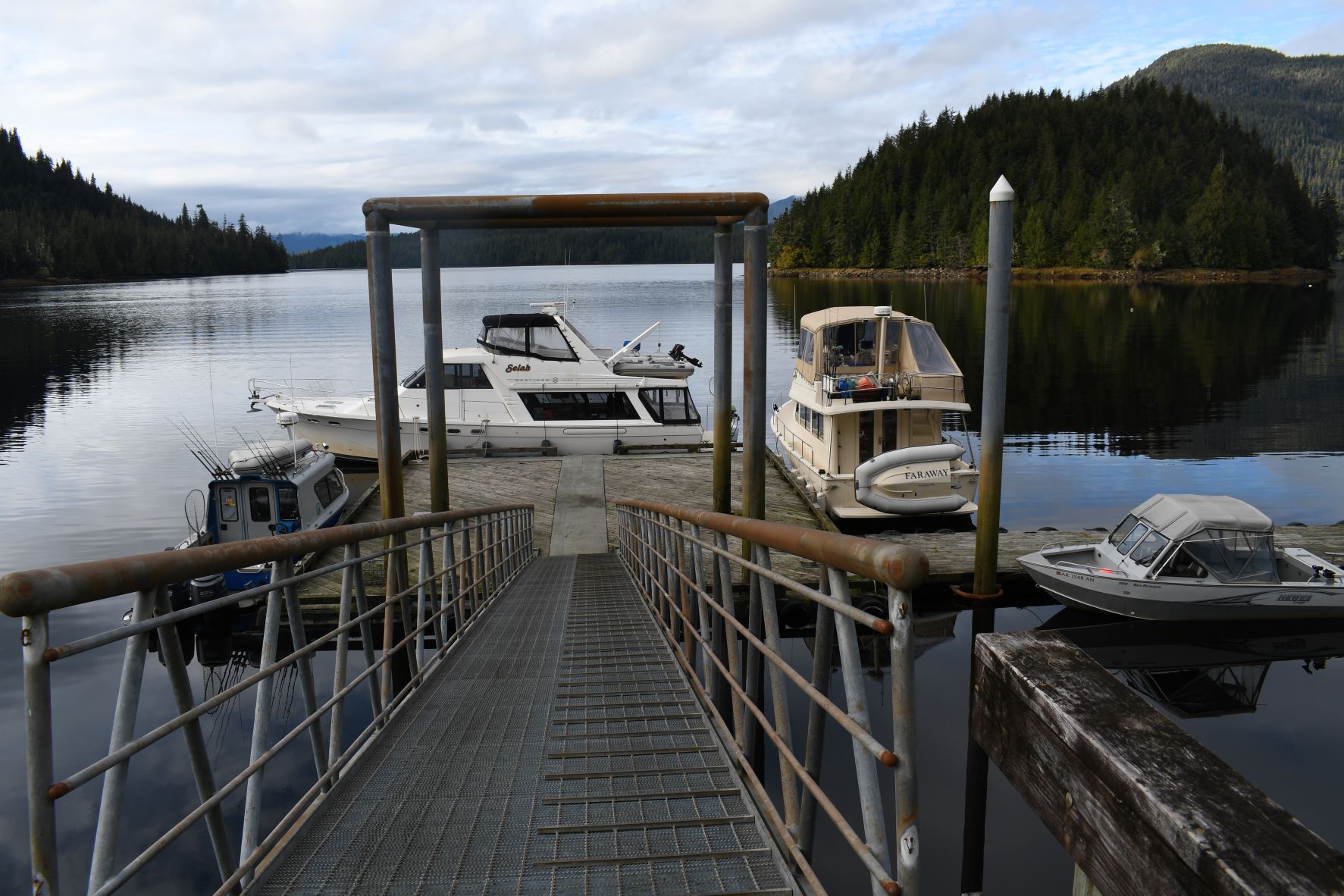
I turned into Traitors Cove and made my way up to the point where you can see the USFS dock in Marguerite Bay. I could tell even without binoculars that the dock was plugged with boats, which surprised me. But it is hunting season and a good weather weekend to boot, so I suspected most of those boats were people hunting.
About that same time, I noticed a very small buck with teeny-tiny antlers (spikes we call them) swimming across in front of the boat.
Here's a shot of the dock from pretty far out.
Since the dock was plugged, I went over to the side near where Margaret Creek dumps out into the salt water. There is a large area of shallows there that is a good spot to anchor. I dropped my anchor there at about 11 AM.
One of the draws to this area is its scenic beauty. I know that phrase gets overused and becomes a little diluted, but I think the scenery and views from inside this cove are unique and worth photographing. Here are a few shots I took during the short time I was on the anchor.
Since I had skipped breakfast, I was ready for an early lunch. About noon after I had finished lunch, I started to drop the raft down so I could go ashore and take a hike up the logging road. It takes about 45 minutes to get the raft in the water and ready to go. But before I could do much, I noticed 2 boats leaving the dock. So, I pulled my anchor and moved and found a spot at the dock to tie up.
The big boat in front is a 47' Bayliner named the Selah, home ported in Ketchikan. There are 2 big signs on the front side of the dock stating that it is for loading and unloading only, and there is no moorage there. I guess the people on Selah felt the rules do not apply to them. More likely they just figured that if someone asked them to move, they would.
A little before 1 PM I got my gear ready for a hike up the road. I always try to be prepared for hikes like this. I loaded my pistol and got spare ammo ready. This is mostly for bear protection as there are many bears in the area. I have never had an issue with them, but it is better to be prepared. I packed my Garmin InReach Explorer satellite communication device and a small handheld VHF radio. If I had an injury or a medical emergency of some sort it would be good to be able to call someone for help. A bottle of Gatorade, my camera, my hiking staff and I'm ready to go.
This is the sign at start of the logging road.
This is the US Forest Service cabin that is just a little way up the road from the dock. I assume they have USFS people stay here when they have work to do in the area. Not as spacious or plush as the accommodations at Shoal Cove but it looks very comfortable. They have a big generator and a large fuel tank, some solar power, and of course, a 4-wheeler for running around the logging road system. If they have a lot of work to do, they will bring trucks out via barge.
About a half mile up the road from the cabin there is a fairly large stream coming off the hillside, so the USFS has a freshwater collection system there. Amazingly there is a hose running all the way from the stream back to the cabin, a very long way.
About a mile or so up the road there is a cutoff that goes down to the bear and fish viewing platform. Of course, I knew that this late in the season there would be neither bears nor fish there, but I walked down there anyway, just to get some photos. It is a nice trail down off the logging road that takes about 10 minutes to walk down to get to the viewing platform.
During the peak of the bear viewing season, they have large, camouflaged panels that hide the people on the platform from the bears a little better. After the bears and fish are gone, they take the panels down for the winter.
This is the plaque that is at the platform, memorializing when it was built and who was involved in the project.
Right at this site in the creek there is a little waterfall which makes it difficult if not impossible for the salmon the traverse, so the USFS and the Dept of Fish & Game have constructed what they call a fish ladder which allows the fish a way to get around the obstruction. You can see parts of the fish ladder hidden by the brush near the bottom of the photo. And yes, the fish eventually find it and make their way up it.
Up on the logging road they have an outhouse, presumably only for the tourists because every time I have come by it is locked.
During the hunting season people frequently stash 4-wheelers, motorcycles, and sometimes even trucks, in the brush for use when they come to the area to hunt.
About a mile and a half up from the dock there is Margaret Lake, and a bridge that crosses the logging road. It affords a beautiful (there's that word again) view of the lake from its outlet into Margaret Creek. I think this is one of the most beautiful spots in SE Alaska and even though I probably have dozens of photos from this very spot I continue to take more whenever I come here.
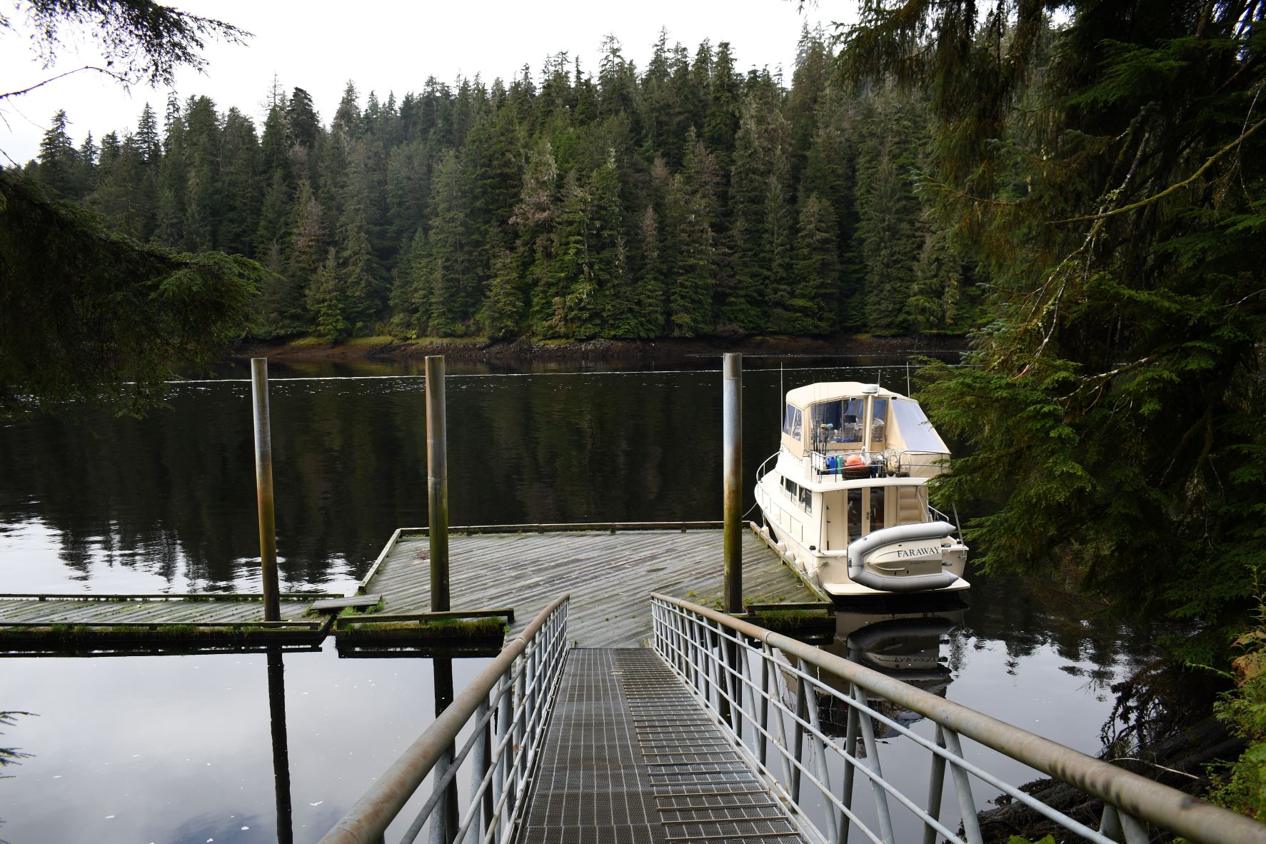
I got back to the boat at the dock at about 3:15 PM. There was a mist forming over some of the waters of the cove. I couldn't resist just a few more scenic photos of the area as seen from the dock.
The big 47' Bayliner people had 3 motorcycles from which they were hunting the road system. Unfortunately, I left before they did so I didn't get to see how and where they loaded these bikes on the boat.
In the evening just before dark another 47' Bayliner named the Willow, homeport Ketchikan, came in and tied up to the mooring buoy which is nearby to the dock. The mist in the area created an interesting view of the boat. The people from the Willow came in near the dock in their skiff and were chatting with the owner of the Selah about the tips and tricks for owning and operating the 47' Bayliner.
When I got up in the morning, I saw that the spiders had been quite busy spinning webs along the ramp that goes to shore. I wonder if they fight over who gets the best spots.
I usually have cold cereal for breakfast, but this morning I splurged and made some pancakes. I apologize in advance for once again waxing philosophical. While I enjoy coming to remote spots like this and enjoying the scenic beauty they offer, it also at the same times makes me sad to have to come alone. My wife has left, deciding that she no longer wants to live in Alaska. My 2 daughters live far away, and most of the time I make these trips alone now. Making pancakes like this brings to mind all the countless times I've made batches of pancakes for hungry kids and grandkids. I miss having family around.
One last photo before heading back to town.
The weather forecast called for this good weather to end Sunday evening, so I wanted to get back to town fairly early in the day. I pulled out about 9:30 AM. I was concerned about the fog. There were several crab pots set in the bay and at times I could not easily see them.
But I made my way slowly out of the bay and into Western Behm Canal with no issues. The fog was thick for about an hour, and I had no radar, so I went very slowly, watching carefully for other vessels and pot buoys.
Once the fog cleared it was an uneventful but enjoyable ride back to town. I got back into my slip in Bar Harbor at about 1:30 PM, logging about 54 nm for this trip.