Sunday, September 18, 2022

2022-09-16 Port Stewart and Naha

After my last trip, which was salmon fishing, I needed to clean out the cooler on the back deck because that's where I keep the fish.  I have one of those new style "slinky" water hoses, not plastic or rubber.  I really like it because it is so flexible.  I cleaned out the cooler and then went to coil up the hose.  A section of the hose had hung over the side of the dock and the strong current had swept it up under the stern of the boat and caused it to get tangled up in either the props or the rudders or both.  In any case I could not free it by pulling.  I was grounded for a few days.  After literally decades of avoiding crab pot and shrimp pot lines I managed to get a water hose fouled in my props while sitting at the dock.  Diver came on Monday and cleared it out in about 30 seconds.

For this trip I pulled out of Bar Harbor at about 7:30 AM in calm and mostly sunny weather.  Forecast was good for the next few days, so my plan was to go to Port Stewart and spend the night.

As I passed through Clover Pass, I saw "the fleet" was still there, fishing for Silvers I assume.  I have more fish than I can handle as I only have a small 45-liter freezer on board, so no more salmon fishing for me this season.  I would like a halibut, however.

I stopped at the halibut hole out in front of Naha Bay.  I call it a halibut hole because the water all around that area is over 1000' deep, but at this one place it comes up to a depth of about 150' - 250'.  People say that halibut like to come up into those shallow areas from the depths to feed.  I know I have caught many halibut there over the years but have also gotten skunked there as well.

I did not anchor as it is hard to pull my halibut fishing anchor by myself.  It is not on a winch, and I use a buoy pull system to pull it.  It's just much easier to do that with a little help.

Conditions were perfect for drift fishing.  It was right at low tide slack so there was very little current flowing, and there was no wind.  I stayed there for about 3 hours, but alas, got no fish at all.  I just don't seem to have much luck with bottom fishing. My son Steven had the nose for it and would repeatedly find us fish. I sure miss him.


The 2 little spots on the horizon are the floating pontoons of the US Navy sub testing station.  They have a building on land on Back Island, but they also have these 2 floating pontoons out in the middle of Behm Canal.  When they are actively conducting sub testing, they don't want boats running in the area and will frequently call vessels and ask them to go dead in the water for the duration of the testing.


This is the commercial troller Mona Lee.  He was trolling in the area and came up very close to me.  I thought he might call me on the radio because we have a history together, but he just waved.  On May 28, 2011, I responded to his distress call very near to this area.  His engine was running but he was having transmission trouble and could not get it to go into gear.  I always carry a professionally made tow line, so I hooked onto him and towed him into Knudson Cove Marina.  It took me over 3 hours to do that.  It was a challenge to "slingshot" him into the dock as he had no maneuverability, but we got it done.  It was over 11 years ago so perhaps someone else owns the boat now.


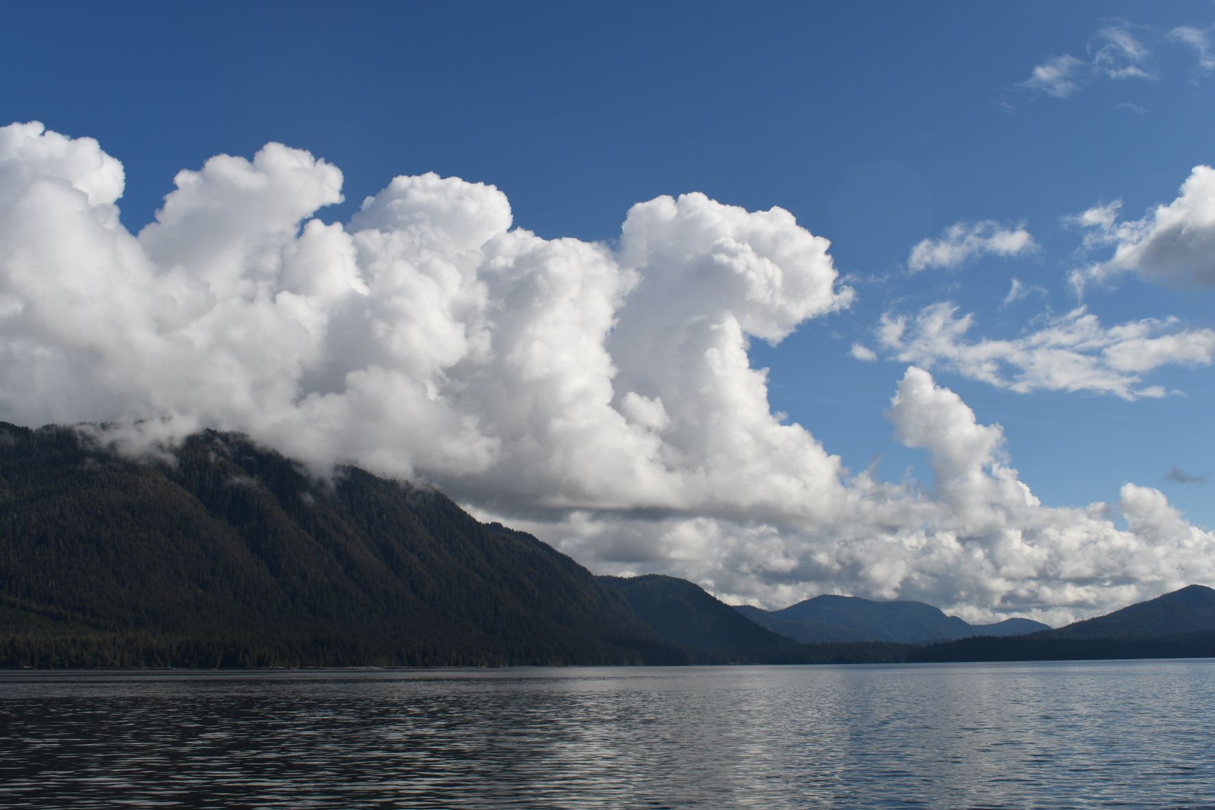
I suspect they have always been there, and I just never noticed, but today for some reason I became very aware of the clouds overhead.  They just seemed to be especially unique and beautiful today.


After 3 hours of not catching anything, I decided to pull my gear and move on.  Port Stewart is on the other side of western Behm Canal, and so I started across.  I think it is about 6 or 7 miles across at that point, and as I was tooling along, I saw something in the water ahead of me.  It took me a minute or two to figure out that it was a deer swimming towards me.  Over the many years I have been boating in this area I have seen deer swimming many times, but I think this is the first time I've seen one so far from land.  It was at least 5 miles to the nearest shoreline in the direction this little doe was swimming.  At first, she turned towards my boat, and I thought she might come up behind the swim step, but at the last moment she turned and continued on, swimming towards the shore about 5 miles away.  I hope she made it.


Several years ago, there was a story with some photos circulating via the Internet about some guys that were out in a boat much larger than mine in winter, January or February, I think.  They were in the Juneau area.  Four deer swam up to them and apparently the guys on the boat were able to haul them on board over the swim step.  There were photos of the deer laying down and chilling on the back deck of the boat.  They took them into Taku Harbor, which is about 20 miles south of Juneau.  Three of the deer were strong enough to walk to shore under their own power, but one of them was so weak they had to take it to shore in a wheelbarrow.  I'm glad I didn't have to try to yard that deer aboard my boat without any help.

I made it into Port Stewart without incident.  The entryway is a little "skinny," but with careful attention to the helm, and a constant eye on the depth sounder and the chart plotter it is very doable.  There is a little "nook" just to the right as you go in, and that is the best place to anchor.  


Port Stewart can be a beautiful place to spend some time.  When the weather and the lighting conditions are good there are some really beautiful vistas.  I enjoy just being in the area.


I put the raft in the water and prepared and baited a single crab to set out for the night.  In the morning I pulled the pot and there were 3 crabs.  Two were inside the pot and the third was hanging onto the outside of the pot.  In Alaska the Dungeness crabs must be 6 1/2" from notch to notch on the outer shell to be legal, and they must be males.  These were all males, but they were all just barely less than 6 1/2".  In hindsight I wish that I had kept a couple, but in the end, I tossed them all back.


When I pulled the anchor on Saturday morning and headed out of the anchorage, I noticed that the autopilot was again not showing a compass heading, which means that it is not recognizing the heading sensor, which is like a dedicated electronic compass.  I have had this happen before and it took literally weeks of time and numerous calls to Furuno tech support to figure out the problem.  There is a small button on the heading sensor labeled "terminal resistor," and sometimes it gets popped.  I reset it and the autopilot was working again.  I think the anchor winch might pull so much power when I am pulling the anchor that it causes this button to pop.  Next time I am pulling the anchor I will wait until I am done with the winch before powering up the autopilot.

When I left Port Stewart, I really did not have much of a plan.  I just knew that I did not want to get back to town too early.  The weather was good, and I wanted to time my return to get into port right before dark.  At this time of year, it is getting dark at about 7:30 PM.

I thought about going into Margeurite Bay for the afternoon, but there are a lot of commercial trollers in the area, and they like to hang out in there, as do the fish tenders.  Also, they are still flying in tourists to see the bears there, so I decided not to stop there.

I found myself right in front of Naha Bay at about 11:30 AM so I decided to pop in there and see if there was room at the dock.  It's a nice place to hang out for a few hours.

There was indeed room at the dock, so right about noon I got in and tied up OK.  There was only 1 other small boat there, but I saw no one else around.


I took a short walk up the trail.  It is very emotional to think back of my many trips here at the Naha.  I was only 27 the first time I came here, and now I am 71.  There have been so many trips with family and friends over the years that come to my mind.  This day I felt a true loneliness here since I am now very much alone most of the time with not much hope of that changing anytime soon.


This is the picnic shelter where we have come so many times over the years for family picnics.  Standing here all alone almost brings tears to my eyes.  I wish that I could be buried here rather than at Bayview Cemetery when my time comes, but I'm sure that would violate umpteen Federal regulations.


An obligatory shot of Roosevelt Lagoon, which is fed by the Naha River.


There was a seal playing around the dock and the ramp.  I heard him slap a few times and saw him briefly a time or two.  I got my camera ready and waited, and waited, but he never appeared again.  But I did see these 3 little birds that came by to say hello to me.


I hung out there until about 4 PM and then started my run back to town.  Lately I have been playing my 20-year-old iPod which amazingly still works and plugs into the stereo on the flybridge.  It helps to have some good music for the 3-hour run back to town.  

I got into stall right on schedule just before dark at 7 PM.

Mileage for this trip was 61.9 nm.

A good trip.

The weather will start getting very nasty soon and I don't know how many winter trips I will be able to make.  Plus, I will be running the City League Basketball program in town and that will keep me tied up somewhat.  I am also going to be offering free beginner guitar lessons soon to kids 16 and under and I don't know how many students I will end up with.  So, we'll see how many winter trips I can squeeze in.


Friday, September 9, 2022

2022-09-08 Salmon Fishing

I haven't posted anything since I got back from Sitka, but I actually have made a few day trips.

This is the time of year that I usually try to get in a good supply of salmon, usually Silvers, for my winter supply of fish.  However, this year is a little different, since I am homeless and living on the boat.  I don't have a big chest freezer to freeze and keep my catch as I always have had in the past.  I have a small 45-liter freezer on board, but it doesn't really hold much.

As I said, I made a few day trips in an effort to get some fish in but was largely unsuccessful.  By unsuccessful I mean I got a few fish but did not get into the fish like I usually do at this time of year.

That's why I did not post blog entries about those trips, as there was nothing very interesting to report.  I went fishing, caught one or two fish, that's about it.

One of my grandsons, Bryan, who now lives in Olympia, asked to come up and go fishing.  He and I fished hard for 3 days in a row and only got a few small fish - very disappointing.  Many many hours of travel time and trolling time for very little reward.

Bryan is 16 now and has a driver's license.

For comparison, here is Bryan in July 2015.


And here is Bryan now.


Quite a difference!

On Thursday 9/8/2022 I decided to make another day trip in yet another effort to find the Silvers.  I finally managed to find them, landing 6 nice fat Silvers in the space of about 4 hours of trolling. Of course, I will give most of the fish away since I really don't have room for it.  But it was fun to catch them, and I will give the fish to people who I know will appreciate it.


I have some engine maintenance coming up so I don't know if I will be able to make any trips until that is complete.  We'll see.


Sunday, August 14, 2022

2022-08-08 Return Trip Sitka to Ketchikan

The canvas lady had finished her work on Thursday afternoon 8/4.  I had some provisioning to do but was eager to get started on the journey back to Ketchikan.  However, the weather forecasts in the area were grim, and there were commercial boats coming into port to wait it out.  I kept my VHF radio on while I was in the harbor, and I would hear the boats talking to each other.  Even though I was very eager to get underway I made the decision to wait until Monday morning to depart. 

My departure time for this first leg of the trip back home was dictated by the time of slack tide in Sergius Narrows.  This is one of those places where the prudent mariner goes through at slack tide. The Narrows are about 18 miles from Sitka, a distance I could easily cover in about 3 hours.  Slack tide was at 2:46 PM, so theoretically I should leave at about 11:30 AM.  But in these cases, I always seem to get antsy to leave, and I convince myself that if/when I get there early, I can just drift around waiting for the slack tide.  Better to get there early and wait than to get there late and miss the slack tide, or so the rationalization goes.

That's my excuse for pulling out of Sitka at 10 AM sharp, much too early for a 2:46 PM slack tide only 18 miles away.

It was a beautiful day in SE Alaska, and I took a few photos of the bridge in the channel before pulling away and getting underway.  I called the Sitka harbormaster to let them know I had vacated the slip.  I was in the harbor for 11 days.


On the way out of the area I passed the area they call "Old Sitka."  That's where the cruise ships dock.  They cannot come into the harbor area near town.  It is too narrow and too shallow, not to mention the breakwater that has been built that basically guards the entrance into town.


Even though I travelled much slower than I normally would I still arrived at Sergius Narrows well ahead of the 2:46 PM slack tide.  I got there about 1:20 PM.  There were a couple of boats drifting around, I assume they were waiting for the slack tide.  

As I approached the Narrows, I saw a few boats coming through from the other side, opposite of my direction of travel.  They were going with the current as I would be opposing it.  

I had been following about a 50' pleasure craft named "Huntress."  I think Huntress must have been a local boat with local knowledge.  Huntress went ahead and went through early, but did not follow the marked channel, instead taking a different route around a small island off to the right of the Narrows.  I figured it he was going through early that I would take a shot at it, so I started through about an hour and a half ahead of the slack tide.

I was definitely fighting the current as I went through.  Even though I revved up the RPM's on the engines I was only making about 4 knots.  But I figured since I was making forward progress and the boat seemed to be handling the opposing current OK, I would just plow on through,

Getting through the Narrows was good because it meant that I could get to Appleton Cove earlier than expected and possibly have my choice of the best anchor spots.

I had stopped in Appleton Cove on the inbound trip.  It is a nice, protected cove with many areas in which boats can anchor.  It can accommodate many boats.  People may say I should have stopped in different places on the way back, but I am basically a conservative person, notwithstanding my many adventures.  I wanted a safe, secure anchorage, and Appleton Cove offered that.

I arrived at Appleton Cove at about 4:40 PM.  There was a large passenger vessel called the "Liseron" anchored in the outer basin.  This is a sister ship to the "Mist Cove," and is about 160' in length.  They had a few skiffs deployed and were running their guests around.  I saw them pick up about 7 or 8 people that were apparently beachcombing in the inner basin.

There were no other boats in the inner basin, and so I got anchored in the best spot.

Distance travelled today was about 50 miles.

A little after I got anchored the Liseron loaded up their guests and their skiffs, pulled their anchor and left the cove.  Then the smaller boats started arriving as I expected that they would.

This is the "Contagious," a small, slow running commercial troller that I had passed along the way up from Sitka.  A little later in the evening I was scoping out the boat with my binoculars and noticed the guy on board wearing a face mask.  Seemed a little strange since I was pretty certain he was alone on board.  I thought perhaps he is "contagious."


Soon after Contagious anchored a couple of other boats came in and anchored nearby.  One was a sailboat named the "Dilligaf."  I would have liked to ask them the meaning of the name.  Also anchored nearby was a 32' Bayliner called the "Pinch Me."  I had seen this boat in the harbor in Sitka and also had heard them when they called the harbormaster requesting a transient slip.  It was funny because the harbormaster did not initially hear their boat name, so he asked for clarification.  The woman on board responded, "Seriously Pinch Me."  So, the harbormaster started calling the boat the "Seriously Pinch Me."  


You can see that it was a very beautiful evening in Appleton Cove.

About 8 PM a very large private yacht (about 100 - 120') named the "Kayana" out of Seattle came in and anchored in the outer basin where the Liseron had been anchored.  Other smaller boats kept streaming in from time to time and found themselves a place to drop anchor.

Since I was out of cell phone range, I had no Internet access and therefore could not check the weather in northern Chatham Strait, which was where my next leg of the trip would take me.  I could not raise the weather channels on my VHF radio.

Chatham Strait is a large body of water and can get downright nasty and dangerous in rough conditions, and I had no desire to face Chatham Strait in those conditions.  I'd rather sit on the anchor for days than to get slammed in Chatham Strait.

I have a Garmin InReach satellite communicator and it allows me to text and email (text only, no graphics or photos) from anywhere.  So, I texted my daughter and asked her to check the marine weather in northern Chatham Strait for the next day.   She sent me a forecast which was very good. I asked her to send another forecast early the next day just for assurance.

The next day I was up early and was underway by about 5:30 AM.  The forecast from Karen had not yet come in, but it looked good and so I got started.

It was several miles in Peril Strait before I made the southbound turn into Chatham Strait.  Conditions were excellent, and it was good day to be running in the Strait.


Right before I got to my destination for the night, Chapin Bay, I started to see sea otters from time to time.  We don't have these around Ketchikan, so it is always a treat to see them.  When I made my 2 trips to Glacier Bay, we saw them in great numbers, but here I only saw singles or doubles.  I tried to get a photo, but they were a little elusive.  They seem to float on their backs while still propelling themselves along in the water.  Don't know how they do that.


Chapin Bay is actually in Frederick Sound, so when I got there, I had Chatham Strait behind me, which was quite a relief.

This is the entrance to Chapin Bay.  I got there about 1:30 PM.  Some may ask, why stop so early in the day?  One has to remember that I was up before 5 AM and had been at the helm underway since 5:30 AM.  Granted, I could probably have made it further along the way into Petersburg, or perhaps into Petersburg itself, but that would have meant several more hours at the helm.  Piloting in calm conditions with the autopilot doing most of the work is not hard, but it is still tiring.  Except for the run between Wrangell and Ketchikan (82 miles) most of my daily runs were about 50 or 60 miles.  I enjoy spending time on the anchor in a beautiful, protected cove.


There were no other boats in Chapin Bay when I arrived, so I anchored in the preferred spot where I had anchored on the outbound trip.  It was dead calm in there and quite beautiful.

Dinner this evening was cooked on the Coleman propane stove on the back deck.


Later in the evening the approximately 50' pleasure boat Grocery Boy came into the cove.  As he went by me I noticed that he has WA registration numbers on the hull, but also had a placard in the pilothouse with AK registration numbers.  Have never seen that before.  He set a couple of crab pots and then dropped anchor quite a way from me at the head of the bay.

Then later the 157' Mist Cove came in and dropped anchor near Grocery Boy.  These were my neighbors for the night in Chapin Bay.


Once again, I got a weather forecast from my daughter for Frederick Sound, which predicted excellent sea conditions.  Good to hear.

The next day I was up early and was underway out of the bay by 5:30 AM.  The weather in Frederick Sound was terrific and the sunrise to the East was photo worthy, although I have to say the photos don't really do it justice.  I need to learn more about my new camera and figure out how to "tweak" the settings to get better photos in different conditions.


The run through Frederick Sound was uneventful.  As I got closer to Petersburg there were more boats in the area.  I saw a US Coast Guard small vessel checking boats and I figured they would stop me.  They did not, just letting me pass by.  Then I saw the boat at the fuel dock in Petersburg and realized they were same guys who stopped me just outside of Wrangell on my outbound trip, so that's why they let me pass on by.

About 1: 30 PM I stopped in at the Petro Marine fuel dock and fueled up, taking on about 93 gallons, more than enough to get me to Ketchikan.

In Petersburg I was assigned the same slip in North Harbor where I had tied up on the way up to Sitka.  I got into the slip OK but the lady from the sailboat Justice in the next slip came over to help which was appreciated.  I chatted with her as I had seen their boat when it was in Ketchikan.  They were from Juneau and had been out 3 months and were on their way back to Juneau.


One of the things that is unique about Petersburg is the herring.  I don't know if it is this way at all times of the year, but it seems that every time I have come through there have been huge schools of herring in and around the harbor and in the channel right in front of the harbor.

People gather on the docks with what we call herring jigs, which is a set of about 6 very small hooks on the same line.  You just throw it out there in the middle of school, jig it up and down a little and you usually get more than 1 herring hooked.  I watched people on the docks doing this, and also from small boats right out in front of the harbor.

If you click on this image to show it larger you can see the angler pulling up the line right at the stern of the blue boat with the gold stripe as 4 herring on the jig, which is not uncommon.


This lady had 3 or 4 on the line, and I tried to get a photo as she pulled them in, but she was too fast for me. She would probably be mortified if she knew I published this photo!


These people were jigging for herring from small boats right out in front of North Harbor.  Those larger boats are either at anchor or are underway in the channel.


There is a cannery right there next to the harbormaster office and there are commercial boats coming in at all times of the day and night to unload, or to buy ice and bait.  This photo is of a fish "tender" unloading at the cannery.  The tenders are under contract to the cannery.  They go out near the fishing grounds and buy the fish from the boats right there at the grounds.  I have never been a commercial fisherman but what I have heard is that the price paid by the tenders is a bit lower than they would get if they sold directly to the cannery.  But if they sell to the tender, they don't have to burn the fuel and spend the time it would take to run to the cannery.  So, each fisherman must decide if he wants to sell to a tender or run to the cannery.  

The tender has a lot of salmon on board, and they use a large vacuum pump to pull the fish out of the hold and send it up to the cannery, which is many feet above them.  At the cannery a row of 4 or 5 guys are grabbing the fish as they come out of the hose and flinging them into bins based on their species.  I suspect this tender had Chums, Silvers, Pinks, and maybe some Sockeye and Kings.


There are a lot of big boats in Petersburg harbor.  I had to crane my neck upward to even see the front of this boat.  This photo is of a 1500 lb anchor on one of the large fish processors.  By contrast, my anchor is 20 kg, about 44 lbs.


Leaving Petersburg southbound for Wrangell and then Ketchikan requires transiting the Wrangell Narrows.  The guide book tells me that the currents meet at a certain point in the Narrows, and that in order to have favorable current through the entire Narrows one must time his entry on the last portion of the high tide such that you arrive at that midway point right at high tide.  Then the current reverses and you have favorable current on the southern portion of the Narrows.  I have tried to hit this mark many times, and have missed it many times.  At other times I have ignored it and just headed into the Narrows ignoring the currents and ended up fighting adverse currents for hours, burning much more fuel than was needed.

For this transit I really tried to figure it out.  The problem that I faced was that when I Googled "Tides in Wrangell Narrows" I got several disparate results.  Some of them were 2 hours apart.  I finally found a table showing the tides at a place called Papke's Landing which is just a mile or so south of the point where the currents meet.  That's the time I used as my mark to hit at high tide.

I pulled out from Petersburg harbor a little before noon on Friday 8/13/2022.  The tide was really ripping right in front of North Harbor.  There is a nav aid marker there and it was heeled way over on its side and the current was rushing past it like a raging river.  I would have liked to get a photo, but the harbor was busy, and I had to control the boat in that current.

When I first headed down into the Narrows, I was barely turning the engines at 1000 RPM and was going over 9 knots.  

When I was just a mile or so into the Narrows I noticed a very large fish tender was creeping up on my from astern, going faster than I was.  There was also a pleasure cruiser right in front of the tender that was moving faster than me.  Some parts of the Narrows are very tight, but there are some more open areas. I sped up a bit until I came to an open area and then I just pulled over to the side and let both vessels pass me.  I fell in line after them and ended up following the pleasure craft all the way through the Narrows.

I have to say I timed this passage pretty well.  I did get to Papke's Landing a little ahead of the high tide, but not much.  So, I ended up having favorable current almost all the way through the Narrows.

When I got to the southern end of the Narrows the big fish tender and the pleasure craft turned away and I headed over towards Wrangell on my own.  It's about 20 miles in Sumner Strait to Wrangell from the south end of the Narrows.

The sea conditions in Sumner Strait were beyond excellent.


As mentioned before I feel an obligation to take a photo of Two Tree Island every time I pass it, so here it is.


Here is the view of Wrangell from about 3 miles out.


I got into Wrangell at about 5 PM, and got tied up at the transient float in Heritage Harbor.

My dock mate was the super yacht "CID."  I Googled it and it comes in at about 115'.  It is just about as wide as my boat is long.


It was a very beautiful evening in Wrangell.  I walked out to the spit in front of the harbor.  There was a boat cruising by in the setting sun.  (I think I need to look into filters for my camera that would allow me to get this type of photo a little better.)


There was a guy and his daughter (I assume) and their 2 dogs playing around on the beach.  They were throwing sticks out into the water and the 2 dogs would race out there to try and get them.


In the early evening as it started to get dark the CID turned on her underwater lights.  This is a relatively new fad in boating, for boats both large and small, but especially for super yachts.  These lights are a few inches below the waterline, all the way around the boat.  I learned that those on the CID cycled through about 6 different colors.  Pretty cool!


Of course I checked the weather in Clarence Strait for the next day and it was excellent.

In the morning I was about 4 AM, checking the weather again.  All good.  

I was just waiting for daylight.  I can run in the dark on radar, but you can't see the logs and debris in the water, so I don't do it unless I have to.  I ended up pulling out about 4:45 AM, just as it was getting light.  The CID pulled out right behind me.  I hadn't even heard her engines running, although they must have been.


The run south through Zimovia Strait and then eventually into Clarence Strait was uneventful, except to say it was stunningly beautiful.

I'm afraid I must wax philosophical for just a moment.  I am 71, almost 72 years old now.  At my age I have experienced the loss of some friends and family to accident or disease.  I have my share of hardships in my life (divorce, loss of a child) but have not experienced cancer or any of the other debilitating diseases that can and do affect many people my age.  On days like this, when the boat is running well and the weather is stunning, I truly do appreciate being still here and still able to experience it.  I'm going to continue to take boat trips as long as I am physically and financially able to do so.

A few final photos taken in Zimovia Strait.


I stopped to get fuel, and then was in my home stall in Bar Harbor by about 4 PM.

Total mileage for the Sitka to Ketchikan run was 292 miles.

It's nice to take trips, but it's also nice to be home after 21 days out.